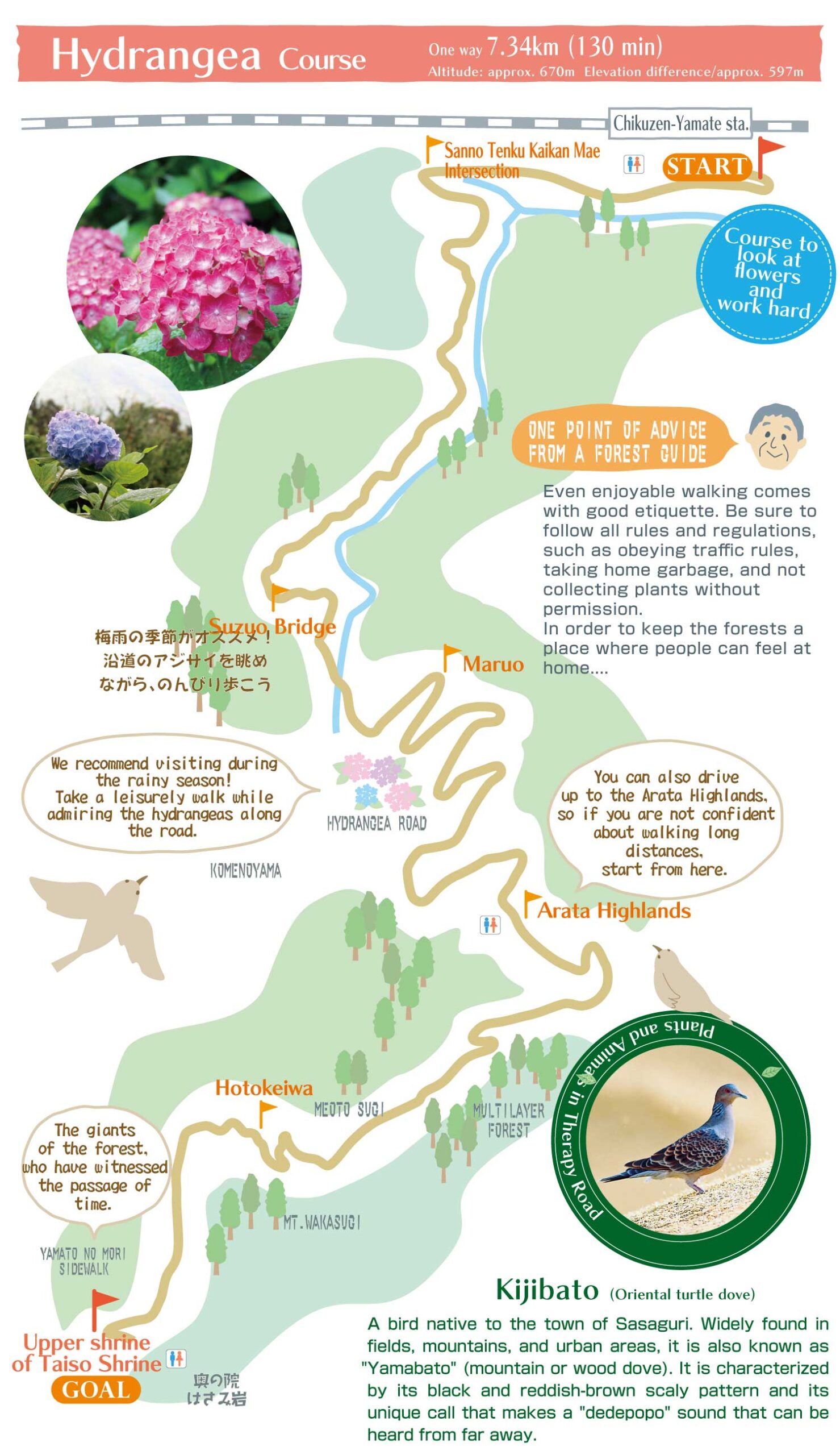
About the hydrangea course
Course overview
This course starts from JR Chikuzen-Yamate Station, climbs up to the Arata Highlands, and from there passes through the Hebitani forest path and continues through the forest to the upper shrine of Taiso Shrine on Mt. Wakasugi. The Hydrangea Road, located halfway along the course, will soothe your soul with its colorful flowers.
Hydrangea Road
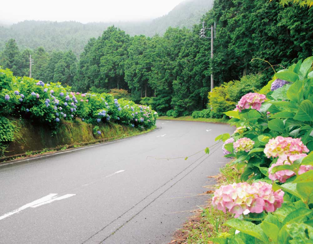 During the rainy season, the roadsides along the Arata Highlands become illuminated with colorful hydrangeas. The flowers, which become even more vibrant when wet with rain and dew, can be enjoyed only at this time of the year. In the fall, this area is also recommended for its autumn foliage.
Upper shrine of Taiso Shrine
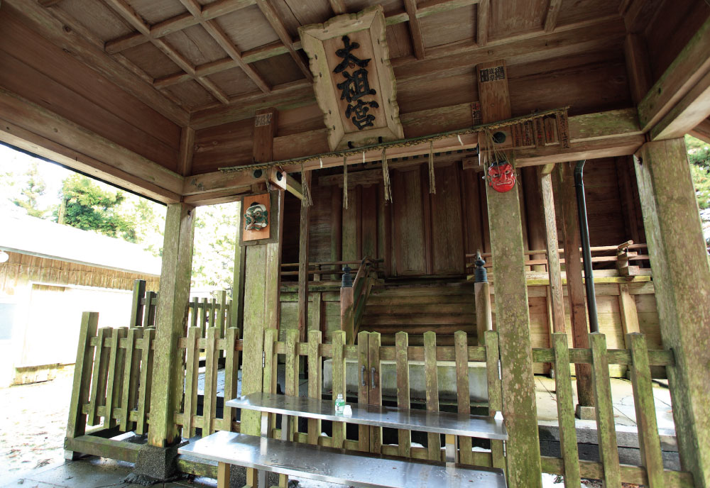 It is said that Empress Jingu visited this shrine to pray for victory in the war against Korea, and the sacred tree, a large cedar, is a natural monument of the prefecture. Nearby is the “Hasami-iwa” (Scissor Rock), which only virtuous people can pass through, and the Okuno-In Temple, where the famous natural spring water “Dokko-sui” flows.
View spot
Komenoyama Lookout,Yamato no Osugi, Hydrangea Road
Rest areas
Komenoyama Lookout,Yamato no Osugi. Benches available.
Watering places
Sanno River
Forest species
Japanese cedar, Japanese cypress
Forest age: 30-230 years
Understory vegetation
Japanese laurel, East Asian eurya, etc.
Insects and small animals: Hare, deer, wild boar, tanuki (raccoon dogs), bush warblers, pheasants, wood pigeons, warbling white-eye
Course information
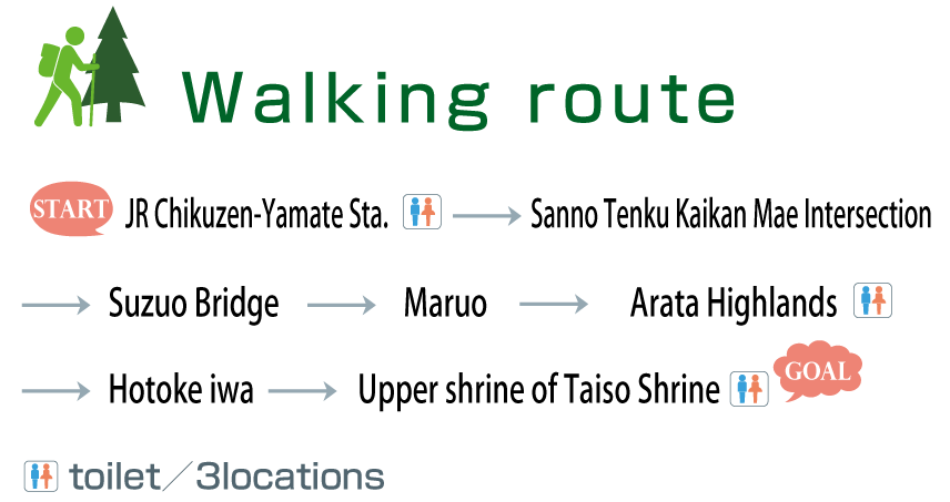
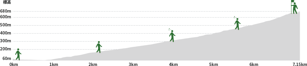
| Total distance | Approx. 7.1km |
|---|---|
| Altitude | Approx. 678m |
| Elevation difference | 605m |
| Topography | Mountainous terrain |
| Slope | Average:13.2%, Min.0%, Max.58.7% |
| Road surface conditions | Dirt, gravel, paved roads |
| Sign (Signpost) | ** locations |
| Restroom | Chikuzen-Yamate Station, Arata Highlands parking lot, Arata Highlands parking lot |